Red Peak Pass 2003
(formerly "Clark Range Trek 2003")
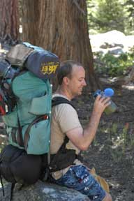
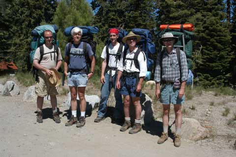 Trek to Red Peak Pass: Pictured, left to right, are Jason Shaeffer (movie producer and cameraman), Jim Schuyler (organizer and still cameraman), Aaron Schuyler (mosquito attractor), Jeff Goldsmith (swimming pool operator), Clark Quinn (trip physician and human subject).
We pulled into Yosemite Valley on Sunday afternoon, June 30th, talked to the wilderness rangers, and secured our wilderness permits. We asked about the conditions at Red Peak Pass and were told they were gnarly, but that someone had made it thru on snowshoes within the past week. We thought that meant the ranger wanted to go with us.
 We camped at the backpackers' campground in Yosemite Valley Sunday night. Pizza and beer all around at Degnan's Loft that evening.
To avoid a 2,800 foot climb the first day, we chose instead to take the shuttle bus from the valley floor up to Glacier Point at 8:30 on Monday morning. After a nice hot breakfast. (Boy were we glad we did that.)  Our driver piloted the big bus up the narrow winding road to Glacier Point in just over an hour. This guy really knew his stuff, from every type of tree to the geology of the region to every forest fire over the past fiftey years.
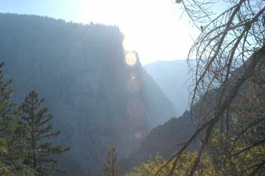
 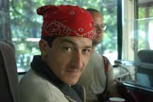 And we were a very jolly crew because we knew we were skipping that 2,800 ft. climb. The view from Glacier Point is spectactular, and everything from the valley entrance to its starting point up in the high countery is visible. Yosemite Falls drops 1,880 feet, right across the open valley from the Point.
 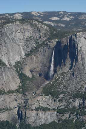 So at 7,100 ft. elevation we begin our trek.
The plan was to walk from Glacier Point to Merced Pass, thence to Red Peak Pass, over the Clark Range, down the north side of Ottoway Peak, and down the valleys to Washburn Lake, and finally back to Yosemite Valley. The planned distance is over 40 miles, with elevation changing from 7,100 to 11,100, then back down to 4,500. We had a custom topographical map prepared by MyTopo.com and you might want to check them out if you need custom maps.
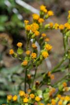
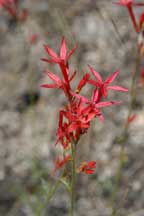
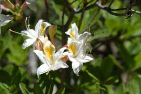
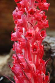
About half of the previous winter's snow fell in April, and therefore it's a late spring in Yosemite National Park. Wildflowers are in bloom everywhere. This expedition will become one of brilliant forms and colors as well as warm, comfortable weather for the most part. Flowers such as these brilliant colors (below) against the grey granite rocks.
We hiked thru 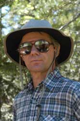 forested areas, thru open areas, and fire-blackened forest areas. We forded streams that were minor rivers - no big problems except for those rocks on the stream bottoms which pinched and tried to puncture the feet. Never deeper than just above the knees, but you'd have to balance the weight of your pack on your back, your shoes tied around your neck so as not to get wet, and all barefooted on rocks in swirling water.
By evening of the first day we reached the first forested areas swarming with mosquitos. (They got worse later.) Aaron served as our mosquito-attractor, suffering hundreds of big bites.
 On the second morning, everyone awoke well-rested and rarin' to go. Water ended up being no problem at all. We were able to filter and fill up every few hours, and easily carried what we needed. Later in the summer, the streams would be dry creek beds with water sources much further apart.
At the end of the second day of hiking, having traversed forested areas swarming with millions of mosquitos, we arrived at 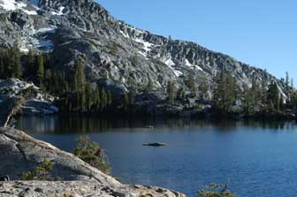 Ottoway Lake, our "base camp" at the foot of Red Peak Pass. A beautiful, calm, dark blue lake, with so many mosquitos you wanted to close the tent flap and stay inside! This was also a big "climbing" day as we gained significant altitude.
And finally our "day of decision" arrived. On the third morning, we marched toward 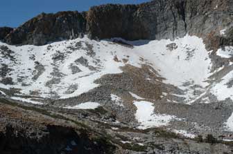 Red Peak Pass, where we would determine whether conditions were gnarly enough for us. Starting from Ottoway Lake, which is just at the tree line (where trees can't grow any higher up the mountain), we moved into rocky talus slopes hanging off the sides of the peaks. Red Peak on our left, Ottoway Peak ahead of us, Merced Peak to our right, and numerous unnamed peaks and ridges all with snow left from the winter. It's like a moonscape - with snow added. Very little of anything growing anywhere. And suddenly the trail ahead of us goes directly into the snow. Under the snow. Vanished.
 Well, at this point you have an advantage if you have a group of five, as we did. You fan out and look for where the trail comes out the other side of the snow field. And if you're lucky, which we were, we could continue up the slopes, turning and losing and then finding the trail again, and avoiding tramping over deep snow as much as possible. One of the hazards of this type of snow is that if you weigh much (as Jim did with his pack) you can "post-hole," breaking thru the surface of the snow with your foot suddenly dropping down to rock
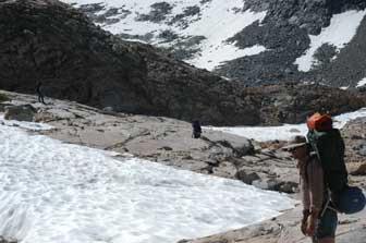
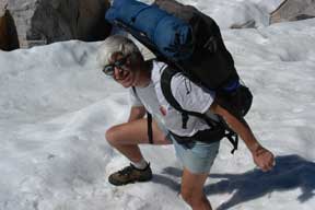 or water several feet below. The result is only a wet foot, if you're lucky. We avoided deep snow in order to minimize the chance that we'd break thru the snow into something unanticipated below. And we were successful. And upward we continued like this, over around 1,300 ft. of climbing, with full packs, on switchback trail when we could find it, otherwise scrambling over boulders - you can get an idea the size of the rocks in the boulder field we were in from the photo. There are two hikers in there among the boulders and snow in the picture below. And the slope went from being
 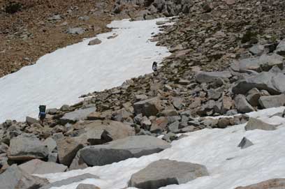 challenging to being more challenging - with the trail narowing - you'd keep your eyes on the trail in front of your feet and your peripheral vision would pick up the slope some hundreds of feet below you off to the side.
For much of this climb it wasn't really possible to predict where the pass was going to be - the trail seemed to go directly up the side of the mountain - "maybe to that little dip in the ridge ahead?" Yes, that was it. We arrived at Red Peak Pass, which was probably 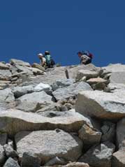 6 feet wide at the top. And suddenly nothing but snow lay ahead of us. And a steep downward slope.
So our decision was pretty simple. And made for us by circumstances. No way we could carry packs safely down that snowy slope. So we broke out the small canister of margaritas, sipped for a moment, and Jason did some video work before we started back down the way we had just come up. Margaritas at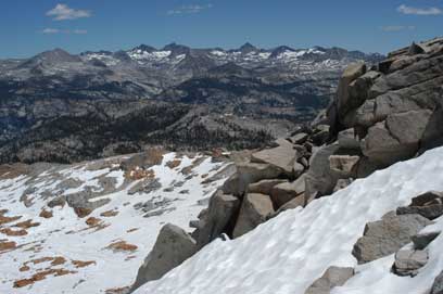 11,150 ft. by the way, are pretty heady, combined with the thin air and the sense that you're standing on top of a big rock pile with a tiny narrow trail down. We were only interested in sipping a little bit. The horizon was framed by Sierra mountaintops in all directions.
Going down the slope was so much easier, of course. The whole party was disappointed by not being able to continue thru the pass, but our alternative was to head back to Yosemite Valley on a  slightly different route, seeing new sights, and were already looking forward to that.
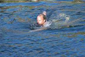
The trail back led thru dense forest, with millions of mosquitos dogging our tracks. To Merced Pass Lake, six miles west of Red Peak. A beautiful, small alpine lake lies there, hidden in the forest, off the trail, and without a soul for miles (except us). 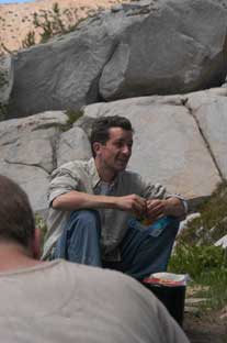 Aaron found a wonderful flat expanse containing a previously-used fire ring, near the water, and we settled in. Jeff, Clark and Jason hit the lake for a swim. And then we sat down to cook up great dinners (of freeze-dried gourmet camping meals).
 The evening was warm enough, but a campfire was built - the first of our trip. And discussions lasted into the evening.
In the morning, we woke with the sun, which doesn't actually come up over the mountains until around 7:30, even though official sunrise is 5:30. We were amazed to see a swarm of mosquitos over the lake. It increased in intensity over time until it 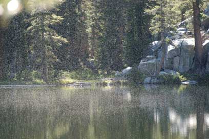 looked almost like fog. A motivator - to get us on the trail. We made our plans for the day, hoping that we might make it all the way back to Yosemite Valley via an alternative route in a single day. The would depend on how much progress we could make - or how fast the mosquitos could follow us.
It was a fine day for the long walk downhill. By lunch time, we had made it to a river we forded at a place we called The Cafe because of the logs that had been sawed to form tables and chairs. We paused, ate lunch, and walked the big log that was felled conveniently so we could cross the river.
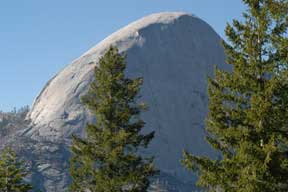 After 12 miles, the familiar "back" side of Half Dome appeared ahead of us, signalling that we were reaching the south wall of Yosemite Valley. There we made choices about trails down (there are two) and proceded to the valley floor. Jeff and Jason went via the Mist Trail under the waterfalls, and Clark, Aaron and Jim took the longer pack trail. We arrived on the valley floor at virtually the same instant, and happily boarded a shuttle bus to the backpackers campground, where we pitched our tents just before sundown. We had completed roughly 15 miles, bringing an end to a trip of 40 miles with climbs of over a vertical mile, and drops of a mile and a half.
 But we weren't tired yet - so we hiked to Yosemite Village in time to find that the pizza parlor had closed for the evening, but we successfully boarded the shuttle bus again and ended up slurping down pizza at Curry Village.
 Trek to Red Peak Pass: Pictured, left to right, are Jason Shaeffer (movie producer and cameraman), Jim Schuyler (organizer and still cameraman), Aaron Schuyler (mosquito attractor), Jeff Goldsmith (swimming pool operator), Clark Quinn (trip physician and human subject).